


Begin Your Trail to Membership

support the trails you love through membership

Bonneville Shoreline Trail BST planning 2026

Trail to Membership is Trails Utah’s annual membership campaign, highlighting our current trail projects and planning efforts that need steady support to move forward.

While grants and one-time donations often cover materials and construction costs, your membership powers the long-term work—planning, permitting, coordination, partnerships, etc.—that make trails possible.

Our goal with the Trail to Membership campaign is simple: if any of our trail projects resonates with you, we ask you to consider becoming a member and a part of that trail’s path to completion 👣

2026 Trail Spotlights

From May through October, each month will spotlight a different trail or planning effort to show what it really takes to move projects forward 👇

 
🗺️ In June we spotlighted the BST Strategic Planning Toolkit
🪏 Now, we’re spotlighting the recently completed 1.2 new miles of BST in Herriman

current trail spotlight

Herriman section of Bonneville Shoreline Trail

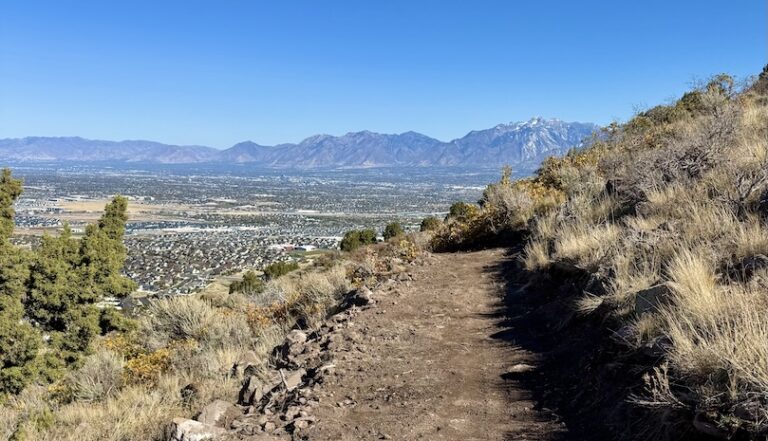
Herriman City Bonneville Shoreline Trail looking over SLC

________________________

This month, we are celebrating the official grand opening of 1.2 brand-new miles of the Bonneville Shoreline Trail (BST) through the Herriman foothills—a very special section of trail that almost did not happen.

The effort to build this section of the BST began back in 2018. An early alignment had been mapped along the ridgeline separating Herriman from Camp Williams, while the actual Bonneville bench—discernible by a band of smooth, round rocks where ancient waves once rolled them back and forth—sat farther below, about midslope. Seeing an opportunity to bring the trail closer to the historic shoreline, Jo Darton, a fiery redhead mountain biker and passionate trail advocate, headed into the foothills with her husband to map a route closer to the ancient lakeshore.

Jo brought the results of their fieldwork to recreation planner Eric Blackett, who worked to create a new map and alignment for the BST. She then invited Jim Byrne, one of the original founders and developers of the BST, along with Trails Utah Board Chair and BST Committee Chair John Knoblock, to walk the proposed route.

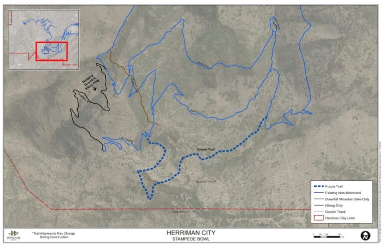
Herriman City, Utah trail network map

Everyone agreed: the views were spectacular, and the alignment would make a fantastic new section of trail. Jo brought the proposal to Salt Lake County Parks and Recreation, which agreed to help move the project forward. Trails Utah then applied for funding through Salt Lake County’s TRCC grant program and helped raise the matching funds needed to greenlight construction.

Plans were in place for Trails Utah to manage construction in 2020, but COVID altered those plans. We were notified that the County needed to rescind the awarded funds and redirect them toward COVID relief efforts. Toward the end of 2021, funding was reinstated, and we were once again preparing to hire a trail builder and move construction forward in 2022.

But another major hurdle soon emerged.

As planning shifted toward implementation, a small group of nearby residents opposed to the trail became concerned about a new route being built behind their homes. Led by a savvy attorney, eight homeowners filed a lawsuit against Herriman City, the landowner permitting the development. They also sued several local trail advocates who had helped champion the project—a surprising development, given these were volunteers working to create a local recreational trail for their community.

At more than 300 feet above the homes and over a quarter mile away, the originally proposed alignment posed no real threat to privacy or property from hikers, runners, or mountain bikers. But faced with a lengthy and expensive legal battle, Herriman City settled, and the previously approved alignment had to be scrapped.

The lawsuit was settled in late 2023, requiring the BST alignment to move farther uphill and away from neighboring homes. The settlement also required an existing trail—originally constructed by the developer in 2013 as a firebreak and located even farther below the proposed BST—to be removed and reseeded. Trails Utah was suddenly back at square one, needing a new alignment to be designed, plotted, and approved by the entire Herriman City Council. That process took another year.

By fall 2024, approvals were finally in place, but there was not enough time to hire a trail builder and complete construction before winter. In 2025, work resumed on a newly approved alignment vetted by both Herriman City Council and the plaintiffs’ attorneys. The new route sits another 1,500 feet farther from the neighborhood and roughly 500 feet higher, while even lower access trails on the mountain had to be removed as part of the settlement so nearby residents could not easily reach it.

Today, the completed trail links east and west sections of Eric’s Trail near Blackridge Reservoir, creating a continuous multi-use route that expands the Herriman trail system and moves the region one step closer to a fully connected BST. Winding through Gambel oak, the trail includes grade reversals and small rollers for drainage, along with a wide tread designed to accommodate a variety of trail users.

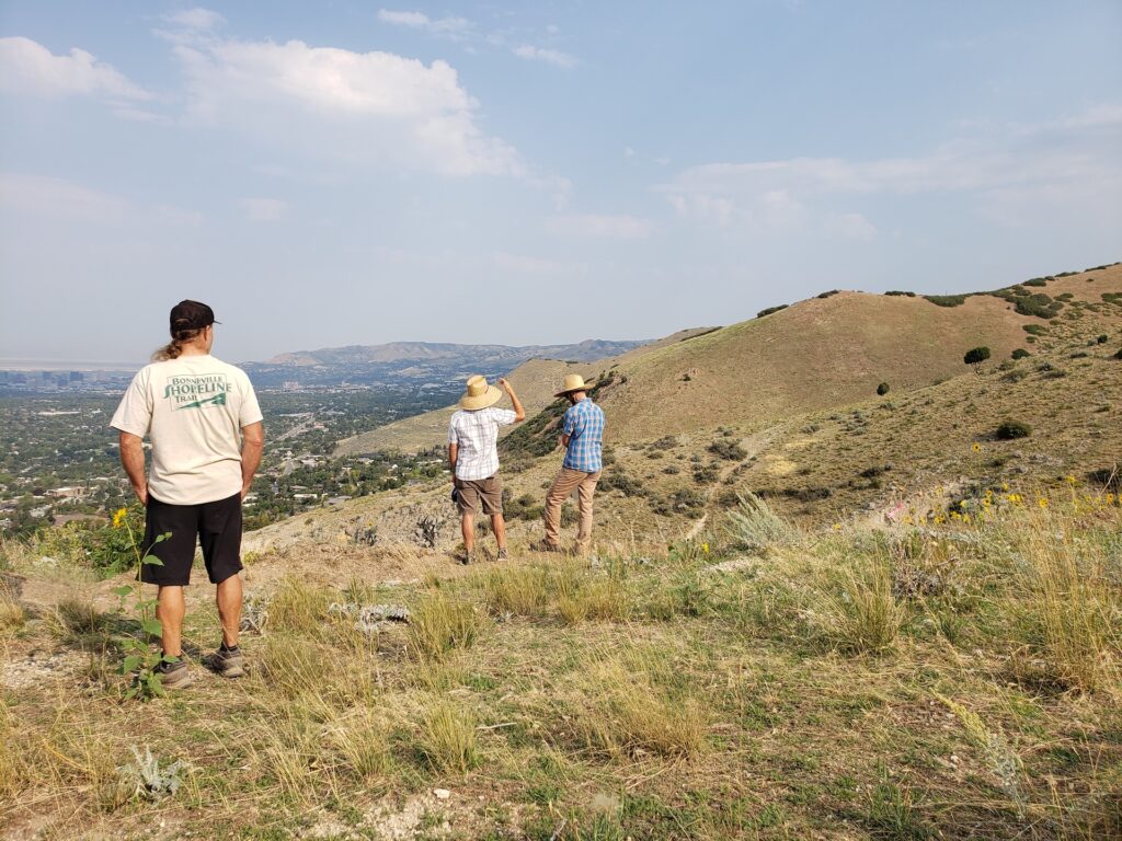
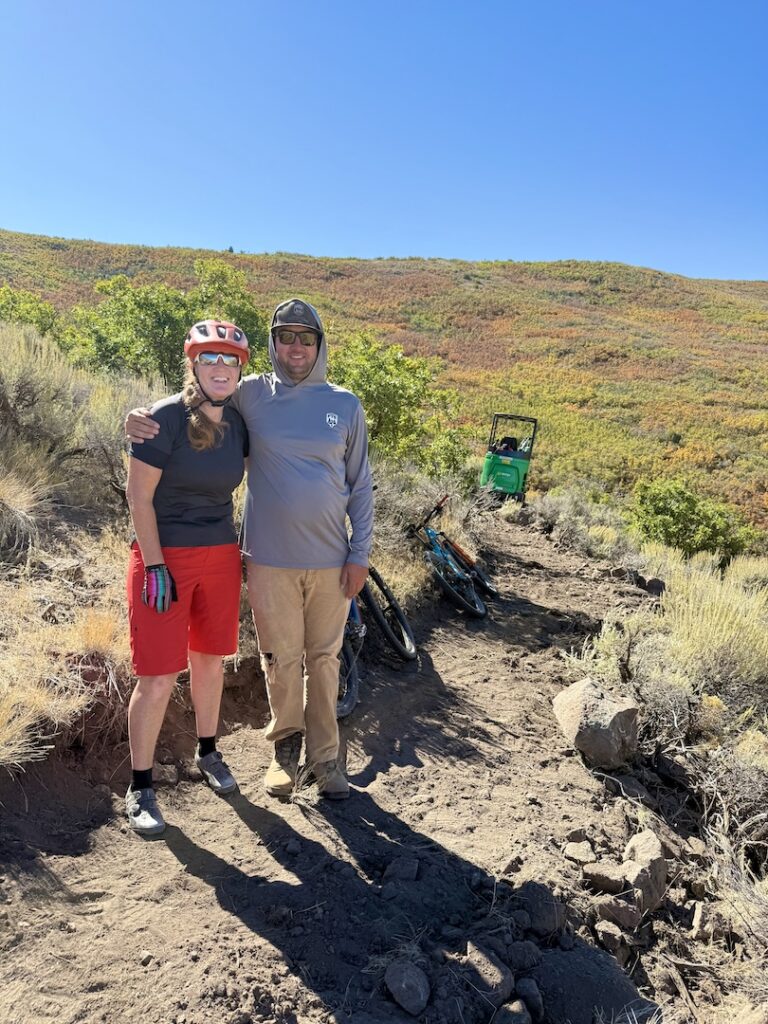
Herriman BST with Jo Darton and Brody Kunz
Click here to view the trail route on AllTrails

The trail is open to hikers, runners, mountain bikers, equestrians, and Class 1 pedal-assist e-bike riders. It can be accessed via a one-mile route from Juniper Crest Road or a 1.5-mile route from Blackridge Reservoir Trailhead.

This coming Saturday, May 30, we’ll gather to celebrate the official grand opening of this new stretch of trail that winds across the Herriman foothills. Now—and well into the future—we can hike, ride, or simply meander through a beautiful piece of our own backyard.

We are grateful to Salt Lake County’s TRCC grant program for helping make this project possible, and to Herriman City for remaining committed to the trail through years of delays and redesign. Trail construction was carried out by Forestry and Trails Solutions.

Herriman BST is a reminder that even a one-mile trail takes years of planning, partnerships, funding, and coordination to move from concept to construction. From securing funding and aligning partners to creating new trail connections between the Wasatch and Oquirrh foothills, projects like this move forward through long-term collaboration.

Consider becoming a member today and help make the full vision of the BST a reality ⛰️

👉 Interested in our previous year’s Trail Spotlights? You’ll find them in our Trail Talk newsletter archive.

🗺️ or, click here to jump to our 2026 trail spotlights

Membership perks

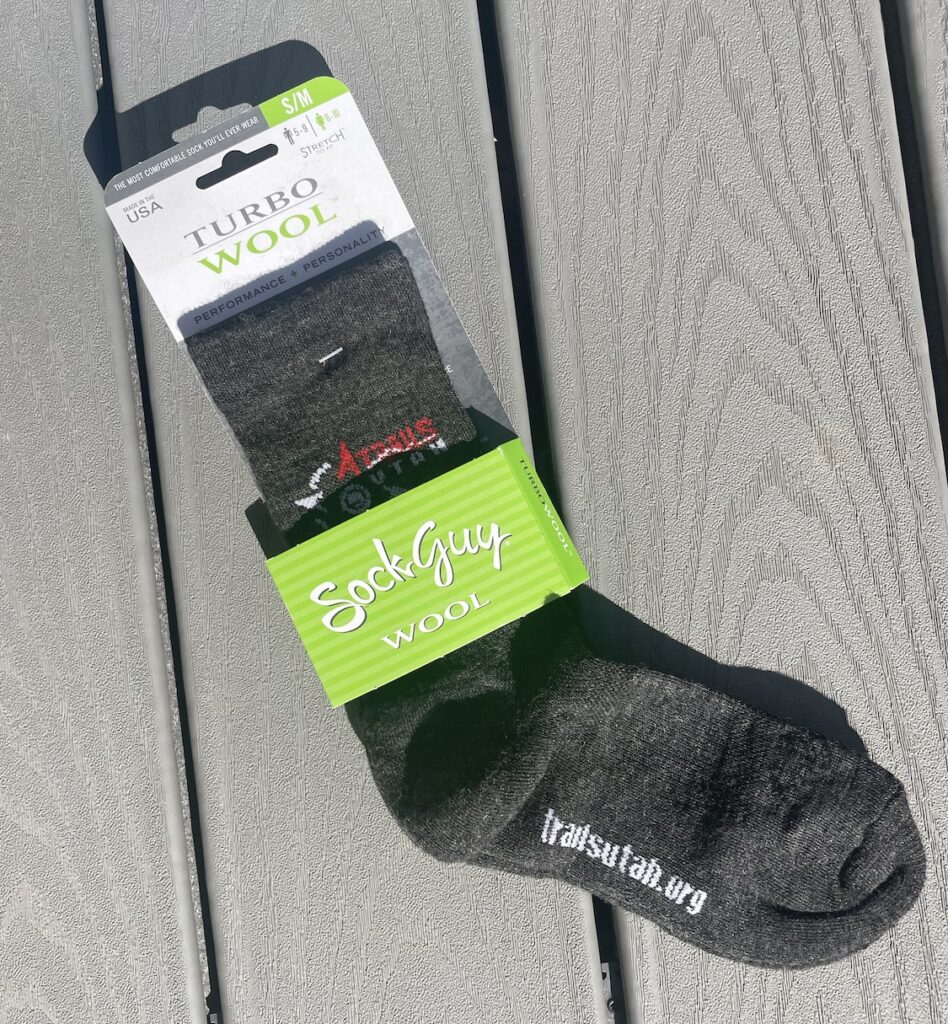
Depending on your membership level, you may receive thank-you perks like lunch with our Executive Director, a custom TU ceramic mug, TU hats or socks, annual limited-edition shirts, stickers, and more.

Pingora Lucid 20 pack—front
Custom Trails Utah mug
Trails Utah Turbo Wool Socks
Trails Utah stickers

additional perks

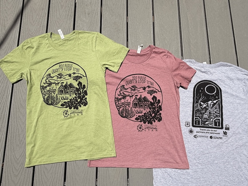
Trails Utah’s 5th annual custom t-shirt is almost here!

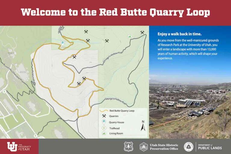
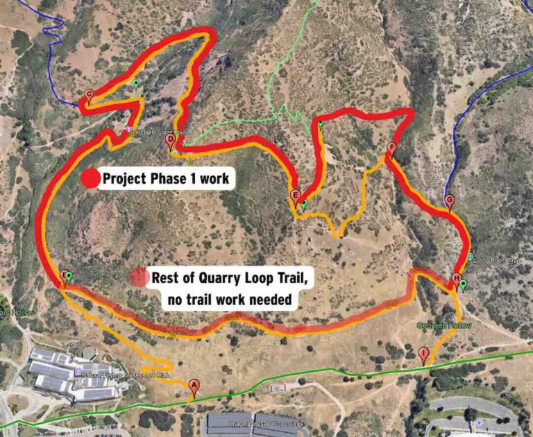
2026 Quarry Loop Trail t-shirt design

About the Artist:

Wyatt Steward (Little Crow Creative)
 
Wyatt Stewart is a printmaker based out of salt lake. Wyatt works primarily in relief printing in black ink. The stark contrast in his print designs compliments his colorblindness, a hurdle that is not insurmountable, but often pushes Wyatt to think in texture more than in color. Wyatt’s artistic vision is drawn from a long history of camping and hiking and connecting with nature, he attempts to capture the serene in only black and white. Wyatt is as any artist is, the critic that yearns to see their own delicate balance of technique and intention flourish.

Trailhead

$25

Scout

$50

Trekker

$150

Pathfinder

$250

Summit

$500

Prefer to give on your own terms? Head over to our donation page, where you can choose the amount and frequency you’d like to give.

Unlike memberships, which include perks, donations are 100% tax-deductible. It’s a simple way to maximize your impact while still fueling Utah’s trails.

Looking To Renew your membership?

If you were a member in years past, you can log in to renew your membership here. If you have never created a login, send us an email and we’ll set you up!

Why Join Trails Utah

Trails Utah is a nonprofit powered by members like you. Your support builds sustainable trails, protects open space, and creates more opportunities for Utahns to get outside.

Join today and help us build The Greatest Trails on Earth™

2026 Trail to Membership spotlights

May '26 trail spotlight

Bonneville Shoreline Trail (BST) Strategic Planning Toolkit

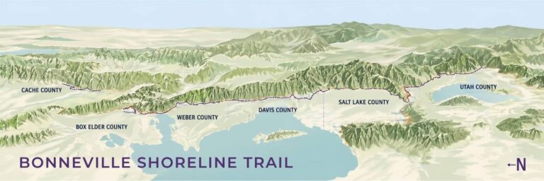
Bonneville Shoreline Trail graphic

________________________

We’re kicking off our Trail to Membership series with an inside look at a large-scale planning project: the Bonneville Shoreline Trail Strategic Planning Toolkit.

With about 173 miles completed out of a planned 280, the BST is already one of Utah’s most ambitious trail visions. Especially when you consider that moving even a single mile forward requires support from land managers, local government agencies, and neighbors, securing a buildable alignment for the trail, and then get funding commitments in place by writing and winning grants. All of this must come together before we can move into actual trail construction.

This work takes a huge amount of time, access to a wide range of resources, and buy-in from everyone involved to ensure the trail can be completed before hurdles such as private ownership makes future connections more difficult.

Trails Utah is currently leading a planning project designed to support future BST construction by creating a shared inventory and planning resource for Trails Utah, local governments, land managers, and trail partners to complete the Bonneville Shoreline Trail (BST). To do this, we have teamed up with Trust for Public Land, a nationwide nonprofit organization dedicated to protecting open spaces for trails and parks, and Kinesava Geographics, a mapping company with an outdoor recreation emphasis, specifically on trails. Brandon Plewe, the mastermind behind Kinesava Geographics, is a passionate advocate for the BST and is responsible for some of the most extensive mapping and data collection on this trail to date.

So far in 2026, the team has conducted outreach to more than 100 stakeholders, connected with dozens of municipalities, and collected hundreds of documents related to the BST. Every map, plan, and legal document we gather is critical to ensuring that the BST remains accessible and well-maintained in perpetuity.

One early result of this work is this interactive map of the BST (map also found at the bottom of the text on this page), where anyone can find access points, official and unofficial stretches of trail, and potential routes where the trail could eventually be built.

Why this planning work matters

While the BST has been widely successful as a concept, getting all 280 miles fully connected and properly established remains challenging. About 173 miles currently exist, but many remaining gaps are complicated by on-the-ground issues like private property constraints, unmaintained easements, and competing uses on parcels that could support future trail sections.

The BST has long been recognized as a major statewide trail vision. It was designated as the State of Utah’s Millennium Legacy Trail in 1999 and has received additional federal recognition through efforts like the Bonneville Shoreline Trail Advancement Act of 2022 and more recent legislation introduced to study the feasibility of designating the BST as a National Scenic Trail. Even with that support, completing the trail still requires detailed, parcel-by-parcel planning.
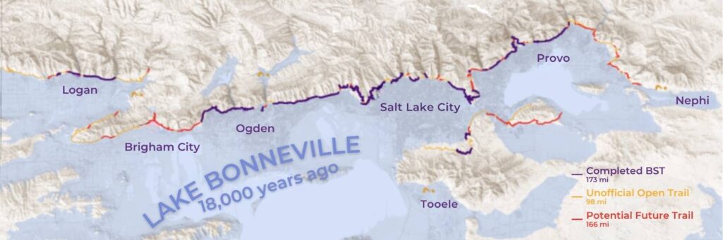
Bonneville Shoreline Trail (BST) 18,000 years ago

Through this effort, Trails Utah and its partners are collecting and organizing the data needed to identify remaining trail gaps and prioritize the next steps to close them. This includes analyzing the many conditions that shape future trail connections, including:

  • physical and geographic constraints
  • ecological considerations
  • legal agreements and easements
  • land ownership
  • political and jurisdictional factors
  • social and cultural considerations

Bringing these layers together helps create a clearer picture of where the BST can realistically move forward. Existing legal agreements that currently establish parts of the corridor may also help guide what kinds of agreements could work on remaining parcels. Over time, this can support a more consistent approach to establishing the trail across different cities, counties, land managers, and local organizations working to complete the BST in their own communities.

This map relies on community knowledge. Once it’s live, let us know if we’ve missed any trail sections, access points, or connections. 

Thank you to the Utah Division of Outdoor Recreation (UDOR) and their ORI grant for making the BST Strategic Planning Toolkit possible!

Trail projects like the BST take years of planning, coordination, and persistence to move forward. 

Consider becoming a member today and help make the full vision of the BST a reality ⛰️